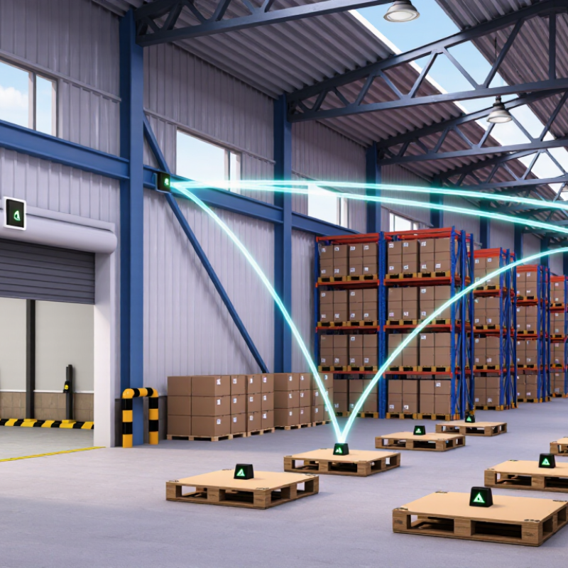
| 01 | Industrial Indoor Navigation | Factories, warehouses, production lines, and automated logistics zones | Fixed anchors transmit synchronized UWB downlink packets to mobile tags | Two-way ranging combined with anchor geometry and filtering | Approximately 10–30 cm in controlled line-of-sight areas | 10–50 Hz, depending on tag density and network load | Reliable asset, worker, and vehicle tracking in GNSS-denied environments | Metallic obstructions, multipath reflections, and anchor calibration requirements | High |
| 02 | Automated Guided Vehicle Navigation | Smart factories, distribution centers, and material-handling corridors | Ceiling or wall anchors provide downlink ranging references to onboard tags | UWB position updates fused with wheel odometry and inertial sensors | Approximately 10–20 cm under favorable conditions | 20–100 Hz for local control, with lower rates for supervisory tracking | Supports collision avoidance, route control, and repeatable vehicle localization | Requires careful map calibration and continuous coverage along travel routes | High |
| 03 | Personnel Safety and Geofencing | Construction sites, mines, ports, tunnels, and high-risk industrial areas | Anchors broadcast ranging or synchronization packets to wearable tags | Zone detection, TDoA or TWR positioning, and alarm-rule processing | Approximately 20–50 cm for zone and proximity applications | 1–20 Hz, with event-triggered alarm messages | Fast proximity alerts and accurate indoor boundary enforcement | Wearable battery life and radio attenuation in underground or reinforced structures | High |
| 04 | Robotics and Autonomous Mobile Platforms | Indoor delivery robots, inspection robots, and service-robot fleets | Multiple fixed downlink references are integrated with the robot navigation stack | UWB ranging fused with SLAM, IMU, camera, or lidar measurements | Approximately 10–30 cm when anchor visibility is sufficient | 10–50 Hz, subject to sensor-fusion design | Provides an absolute position reference that reduces long-term drift | UWB alone does not replace obstacle perception or map-based localization | High |
| 05 | Indoor Asset and Tool Tracking | Hospitals, laboratories, manufacturing facilities, and equipment rooms | Ceiling-mounted anchors deliver periodic downlink ranging opportunities to tags | Zone-level or coordinate-level positioning with database integration | Approximately 20–100 cm, depending on installation density | 0.5–10 Hz for routine tracking | Improves utilization, retrieval time, and inventory visibility | Large facilities require network planning, tag management, and battery maintenance | High |
| 06 | Port, Yard, and Large-Site Navigation | Container yards, intermodal terminals, shipyards, and open industrial campuses | Distributed anchors create overlapping downlink coverage across outdoor work zones | TDoA, TWR, or hybrid ranging with map and vehicle data | Approximately 20–100 cm in open areas; lower performance near dense steel structures | 1–20 Hz for fleet supervision and navigation support | Works where satellite signals are blocked or insufficiently precise | Large-area synchronization, weather protection, and site-wide backhaul are required | Medium–High |
| 07 | Smart Retail and Consumer Indoor Wayfinding | Shopping centers, exhibition halls, airports, and public venues | Fixed beacons or anchors transmit downlink ranging references to mobile devices | Phone or tag-based ranging with map matching and application-layer positioning | Approximately 30 cm–2 m, depending on device integration and environment | 1–10 Hz for navigation and location services | Enables turn-by-turn indoor navigation and location-aware services | Consumer device compatibility, privacy controls, and installation density affect adoption | Medium |
| 08 | Smart Home and Access Interaction | Residential buildings, offices, parking areas, and controlled-access spaces | Door or room infrastructure provides downlink ranging cues to authorized devices | Fine-ranging, proximity verification, and secure access decision logic | Approximately 10–50 cm for proximity and access use cases | Event-driven, typically below 10 Hz during normal operation | More precise spatial awareness than conventional short-range signal strength methods | Security certification, interoperability, and power consumption are important constraints | Medium–High |
| 09 | Sports, Training, and Motion Analytics | Sports venues, training centers, laboratories, and performance-testing spaces | Anchors transmit synchronized reference packets to body-worn or equipment tags | High-rate ranging with trajectory reconstruction and motion analytics | Approximately 10–30 cm in calibrated indoor environments | 20–100 Hz, depending on channel capacity and tag count | Captures player, athlete, or equipment trajectories with low latency | Body shadowing, tag placement, and radio congestion can reduce consistency | Medium |
| 10 | Emergency Response and Underground Navigation | Tunnels, underground facilities, emergency drills, and disaster-response sites | Portable or fixed anchors form temporary downlink reference networks | Ranging, inertial dead reckoning, and resilient local map matching | Approximately 30 cm–2 m, depending on anchor visibility and site geometry | 1–20 Hz, with priority handling for emergency tags | Maintains local navigation when GNSS and conventional infrastructure are unavailable | Rapid deployment, power autonomy, and harsh propagation conditions remain challenging | Medium |